


The Road Taken: From Dusty Tracks to State Highways
In 1877, the newly founded Town of Holly Springs was a quiet, one-square-mile patch on the map. If you were a resident, you likely knew your way around by memory, because the few roads in Town were little more than dirt or gravel tracks without signage.
About 60 years later, in 1945, the town mayor suggested naming many of them. At the time, the official town minutes recorded that "there was some discussion, but the matter was dropped." The residents, it seemed, weren't in any rush.
But change was inevitable. Streets were finally officially named sometime before a 1948 downtown map was drawn, but even then, names weren't set in stone. One of the main thoroughfares was once Rhamkatte Road before it became the more familiar Holly Springs Road. Likewise, Academy Street gave way to Ballentine Street. Today, drivers travel along streets named for prominent citizens—Grigsby, Burt, Alford—or follow those that point to history, like Avent Ferry Road, which once stretched all the way to a ferry crossing on the Cape Fear River. Some roads still lead straight to their namesakes: Bass Lake and Sunset Lake.
Potholes, Pickaxes, and the Price of Progress
In the early 20th century, managing the Town's roadways was a hands-on, community affair. An elected commissioner was chosen each term as the "Streets Overseer," a job that involved everything from ordering gravel and repairing potholes to fixing the Town's tools—shovels, mattocks, and pickaxes.
Back then, a resident’s civic duty literally involved sweating for the Town. As part of their taxes, all males of "road building age" were required to dedicate a certain number of days per year to working on the roads. In 1909, this was a six-day commitment. If a resident couldn't spare the time, he paid 50 cents for each missed day. If he owned a mule, he could provide animal power for the horse-drawn road machine and earn a credit of $1 per day.
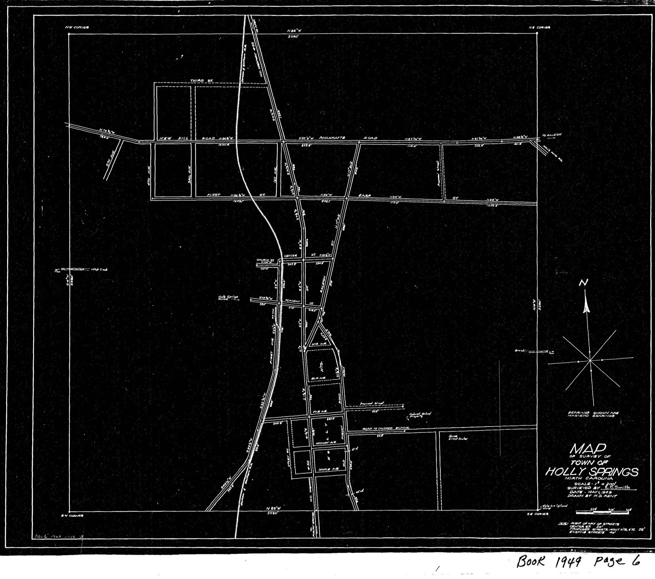
1948 map of Downtown Holly Springs
In those days, streetlights were gas-powered and had to be lit and extinguished by hand. A lucky teenager earned $3 a month for the job. By the 1920s, a new era dawned: electric streetlights began to replace the gas lamps, and road work transitioned from a tax obligation to a contracted job, though one often still completed by residents. During the Great Depression, the labor-for-tax-debt system made a temporary return.
From Dirt Tracks to Paved Highways
The NC State Highway Commission was established in 1915 and gradually took over road maintenance on many roads in the State. In the late 1950s, Powell Bill revenue provided a portion of gas tax funds to municipalities for road upkeep based on the number of miles of Town-maintained roads.
Around this time, the balance of roads in Town finally shifted toward pavement. But the transition was slow. The Town-maintained Estes Lane was paved in 2005.
A major change came in 2002 with the dedication of the NC 55 Bypass. Until then, Main Street—which was NC Highway 55—had funneled all regional traffic directly through the heart of downtown Holly Springs. In 2013, NC 55 was updated to include superstreet intersections, which incorporate U turns to help improve traffic flow, the timing aligning roughly with the opening of NC 540 (the Triangle Expressway) in southern Wake County. The first phase, connecting Holly Springs to US 64, opened in 2012, and the second phase, extending to I-40 in Garner, opened in 2024, providing a vital, high-speed artery connecting the Town to the wider region.
The Town of Holly Springs now has many miles of roads. The Town maintains about 170 miles of mostly neighborhood streets. NCDOT maintains the regional connectors, including NC 55, Holly Springs Road, Bass Lake Road, Avent Ferry Road, Sunset Lake Road, and others.
Today, while the days of the Streets Overseer and compulsory road work are long past, the evolution of the transportation network continues. Ongoing projects, such as the widening of Holly Springs Road and the incorporation of the Intelligent Transportation System, demonstrate that the Town's commitment to modern infrastructure is as strong as the first layer of asphalt laid decades ago.
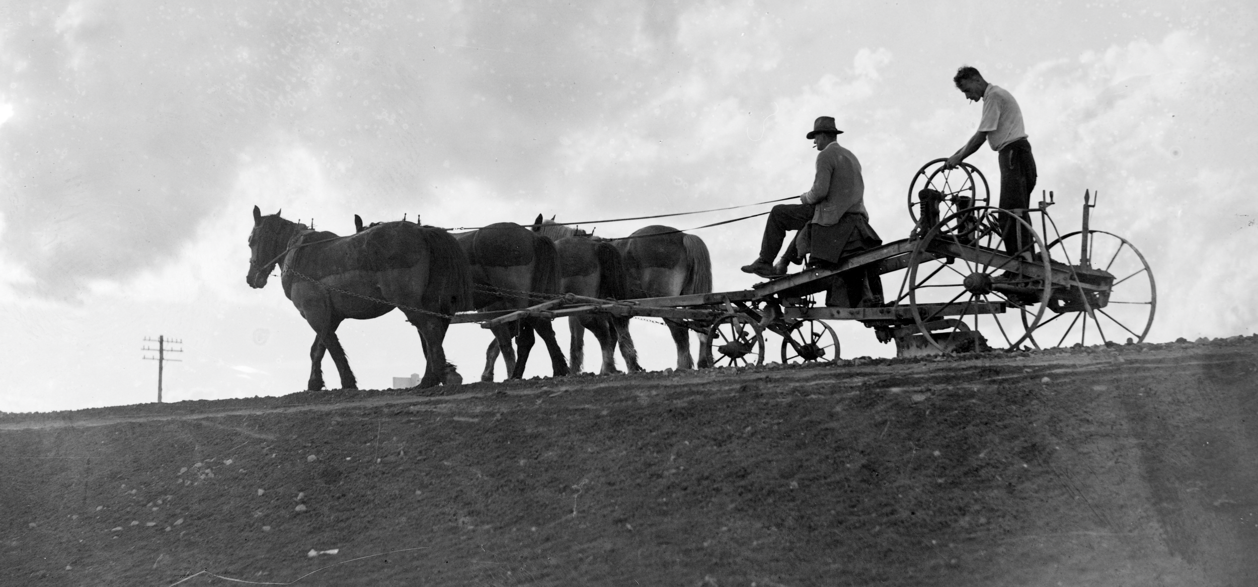
Horse-Drawn Road Machine
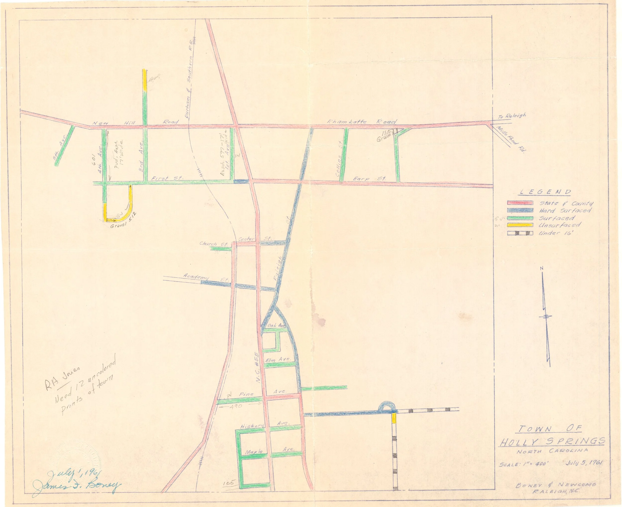
Powell Bill Map, 1961
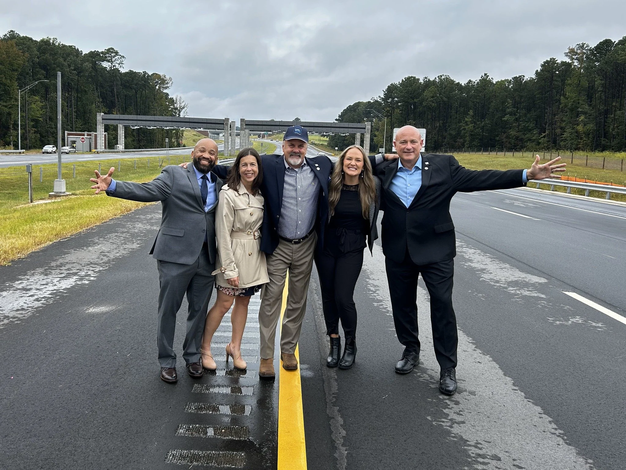
NC 540 Ribbon Cutting, 2024